
Buried deep within Earth’s mantle, two mysterious “supercontinent”-sized structures, known as Large Low-Shear-Velocity Provinces (LLSVPs), may be nearly as ancient as the planet itself. No drill has ever reached them. No human eye has ever seen them. And yet, over the past several decades, they have emerged as perhaps the most geologically consequential features on – or rather, inside – Earth.
The discovery of these structures has forced a quiet revolution in how geoscientists think about the planet’s interior. Standard models of Earth’s mantle described a dynamic, largely uniform mixing machine, slowly churning rock over millions of years. The LLSVPs do not fit that picture. A recent study led by Professor Arwen Deuss from Utrecht University suggests that these massive structures may be more stable than previously thought, challenging the long-held idea that Earth’s mantle is a rapidly mixing environment – instead indicating that there is much less flow within the mantle than previously believed.
Understanding these structures matters well beyond academic geology. They appear to influence everything from the volcanoes erupting at Hawaii to the behavior of satellites orbiting hundreds of miles above the South Atlantic. Working out what they are, how old they are, and what they do is one of the central challenges of Earth science right now.
What Are LLSVPs – and How Did We Find Them?
Large Low-Shear-Velocity Provinces, also called Large Low-Velocity Provinces (LLVPs) or superplumes, are characteristic structures of the lowermost mantle – the region surrounding the outer core deep inside Earth. Characterized by slow shear wave velocities, they were discovered through seismic tomography of the deep Earth. There are two main provinces: the African LLSVP and the Pacific LLSVP, both extending laterally for thousands of kilometers and possibly up to 1,000 kilometers vertically from the core-mantle boundary.
The name comes from a defining physical property: seismic waves – the vibrations that radiate outward from earthquakes – slow down dramatically when they pass through these regions. Seismologists have long known that seismic waves generated by earthquakes do not travel through all parts of Earth’s interior at the same speed, a principle that has allowed them to visualize the inside of the planet at depths inaccessible to humans using techniques similar to those used in CT scans for medical imaging. Deep inside the mantle, there are vast areas beneath the Pacific Ocean and the African continent where seismic waves travel much slower than average.
These blob-like structures are each the size of a continent and 100 times taller than Mt. Everest. The two massive and mysterious regions sitting beneath Africa and the Pacific Ocean occupy roughly 3 to 9 percent of the volume of Earth, and extend thousands of kilometers laterally and up to more than 1,000 kilometers vertically above the core-mantle boundary. As the largest seismic heterogeneities in the lower mantle, they may hold the key to understanding the thermal, chemical, and dynamical evolution of Earth.
The two provinces have been informally named Tuzo and Jason, respectively, after J. Tuzo Wilson and W. Jason Morgan, two geoscientists acclaimed for their foundational contributions to the theory of plate tectonics.
The Slab Graveyard: What Surrounds Them
One of the most striking features of both LLSVPs is what lies around them. The two massive provinces are not isolated – instead, they are encased in layers of subducted tectonic plates, fragments of Earth’s crust that have been transported down into the mantle over millions of years, in what researchers describe as a “slab graveyard.” This is a result of subduction, the geological process where one tectonic plate dives beneath another and is pulled toward Earth’s core.
One tectonic plate dives below another and sinks all the way from Earth’s surface down to a depth of almost three thousand kilometers, or about 1,900 miles. Over geological timescales, this process has created dense accumulations of ancient, cold oceanic crust surrounding the LLSVPs. The current leading hypothesis for the LLSVPs is the accumulation of subducted oceanic slabs, corresponding to the locations of known slab graveyards surrounding the Pacific LLSVP – which are thought to have formed by subduction zones that were around long before the dispersal, some 750 million years ago, of the supercontinent Rodinia.
A 2025 study published in the Journal of Geophysical Research: Solid Earth provided a detailed image of one such slab interaction, finding evidence that an oceanic plate that sank into the lowermost mantle appears to slip beneath the northern edge of the Pacific LLSVP, with a strongly anomalous seismic velocity structure created at the LLSVP’s edge just above this slab, possibly due to the slab uplifting hot material from the base of the mantle.
The two LLSVPs are not feeding equally, either. Circum-Pacific subduction of oceanic lithosphere has continuously replenished the Pacific LLVP with relatively young subducted oceanic crust since 300 million years ago, while the African LLVP comprises older, well-mixed material. Research from the University of Oxford’s Department of Earth Sciences confirmed this asymmetry, showing that the African LLVP consists of older and better-mixed material than the Pacific LLVP, which contains 50 percent more and younger subducted oceanic crust – and that the resulting differences in density could also explain why the African LLVP is more diffuse and taller than its Pacific counterpart.
The Age Question: Ancient Relics or Dynamic Structures?
The most fiercely debated question in LLSVP research is one of time: how old are these things? Large Low-Shear-Wave-Velocity Provinces in the lowermost mantle are the largest geological structures on Earth, but their origin and age remain highly enigmatic, with geological constraints suggesting stability since at least 200 million years ago.
There are two end-member interpretations: the LLSVPs are either fixed, ancient structures or dynamic, young ones. Various types of geological data appear to suggest the African LLSVP has been essentially fixed since 200 to 300 million years ago, including large igneous provinces, paleogeography, and net-characteristics of plate motions. Some studies have even argued for LLSVP stability back to more than 500 million years ago, or even since early in Earth’s history.
The key to resolving this debate may lie in the mineral grains that make up the structures. According to Professor Deuss and her team, these massive structures are likely composed of larger, less numerous mineral grains – “grain size” referring to the size of the crystals making up the rock. The larger the grains, the fewer the boundaries between them. It is these boundaries that normally absorb energy and dampen sound waves. Because the LLSVPs have fewer grain boundaries, they allow sound waves to travel through them without significant loss of energy.
This grain size discovery also reveals clues about the LLSVPs’ age: crystals take vast amounts of time to grow to such enormous sizes, meaning the structures are far older than the surrounding subducted plates. These vast areas, positioned more than 1,242 miles (2,000 kilometers) below the surface, are estimated to be at least half a billion years old.
One hypothesis pushes the origin even deeper in time. Another proposed origin for the LLSVPs is that their formation is related to the giant-impact hypothesis – the idea that the Moon formed after Earth collided with a planet-sized body called Theia. Research published in BBC Science Focus described a study suggesting that pieces of material tens of kilometers big may be relics of the ancient protoplanet Theia, now buried and preserved under Earth’s crust – with the alien material thought to be so dense because it is enriched with iron, forming roughly two percent of Earth’s mass.
A Chemically Distinct Interior
For a long time, scientists argued over whether the LLSVPs are simply hotter than surrounding mantle rock – pockets of residual heat, essentially – or whether they are made of chemically different material entirely. Evidence now points strongly toward the latter.
Global tomography models inherently result in smooth features, but local waveform modeling of body waves has shown that the LLSVPs have sharp boundaries. The sharpness of these boundaries makes it difficult to explain the features by temperature alone; the LLSVPs need to be compositionally distinct to explain the velocity jump.
By using the solid Earth tide – the slight deformation of Earth caused by gravitational forces – the density of these regions has been determined. The bottom two thirds are 0.5 percent denser than the bulk of the mantle. Tidal tomography cannot determine how the excess mass is distributed, however; the higher density may be caused by primordial material or subducted ocean slabs.
Research published in Nature Communications offered a possible chemical explanation. Dense iron-rich bridgmanite – a mineral abundant in the lower mantle – can explain the seismic features of Large Low-Shear-Velocity Provinces, as it can form large-scale thermochemical piles in the deep mantle that remain stable throughout Earth’s history. A separate 2025 study published in MDPI’s Geosciences found even more internal complexity, identifying complex dynamics of high- and low-velocity regions within the Pacific LLSVP, with distinct high-velocity anomalies identified – an observation not previously reported in this region – interpreted as lateral compositional variations within the LLSVP.
Their Role in Surface Volcanism
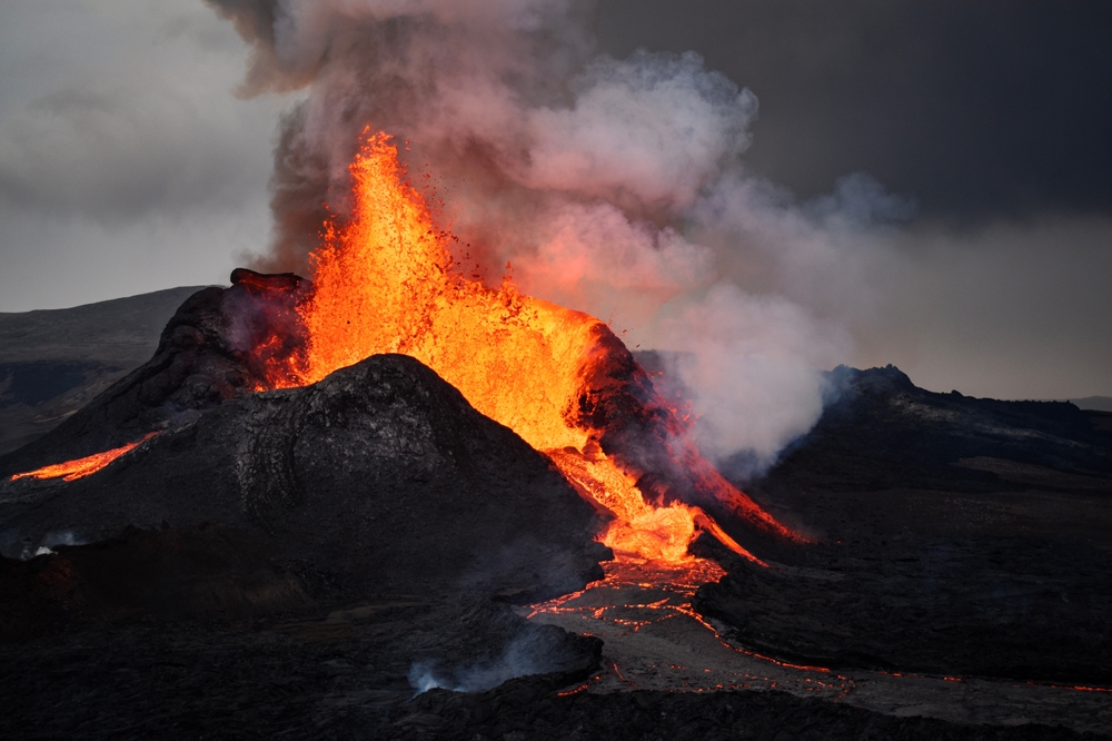
The influence of the LLSVPs does not stay confined to the deep mantle. There is a well-established connection between these structures and some of Earth’s most dramatic volcanic activity at the surface.
One of the strongest links between LLSVPs and surface geology is the observation that mantle plumes preferentially originate at the edges of LLSVPs rather than their centers. Long-lived hotspots such as Hawaii and Réunion are thought to be fed by plumes rooted near LLSVPs, explaining their persistence over tens of millions of years despite plate motion.
The larger and better-understood LLSVP, colloquially called the African blob, sits under the East African Rift Valley, which runs from the Red Sea to Mozambique, where two tectonic plates are slowly moving apart and may eventually split the continent. Sanne Cottaar, a global seismologist at the University of Cambridge who has studied the deep roots of mantle plumes extensively, describes this as “a present-day example of how a large hot upwelling mantle plume that originates at these deep mantle blobs starts to break up a continent.”
The connection to Hawaii has been investigated in remarkable detail. A 2026 report in Science described new modeling work showing that the Mauna Loa and Mauna Kea volcanoes, standing side by side on the Big Island of Hawaii and believed to be powered by a plume of hot rock rising from deep in the mantle, erupt chemically distinct lavas: Mauna Loa’s reflect an older, primordial source, while Mauna Kea’s look to be derived from average mantle rocks – a divide that extends across the first few islands of the Hawaiian chain. Researchers proposed that the lavas are different because the plume beneath Hawaii splits in two, more than 1,000 kilometers down in the mantle, with one branch sampling material from the center of the LLSVP and the other sampling its edge.
The present African LLSVP is thought to have been responsible for the breakup of the Pangea supercontinent, which lasted for 200 million years accompanied by six major large igneous provinces and plumes. A 2026 study published in PMC further showed that a similar LLSVP-driven process may have fueled the breakup of the even older supercontinent Rodinia, with researchers analyzing samples from China and Brazil to demonstrate a series of seven large igneous provinces of supercontinent Rodinia from 940 to 720 million years ago, producing a coherent ring of provinces comparable with the size of Rodinia that resembles the product of an ancient LLSVP whose edges generated plume activity.
Effects on Earth’s Magnetic Field
Perhaps the most unexpected consequence of the LLSVPs is their apparent influence on Earth’s magnetic field – the invisible shield that protects all life on the surface from harmful cosmic radiation.
The South Atlantic Anomaly – a region where Earth’s magnetic field is significantly weaker than normal – seems to be caused by the huge reservoir of very dense rock inside the Earth called the African large low-shear velocity province. The South Atlantic Anomaly (SAA) is not merely a geophysical curiosity. Over South America and the southern Atlantic Ocean, this unusually weak spot in the field allows particles to dip closer to the surface than normal, and particle radiation in this region can knock out onboard computers and interfere with the data collection of satellites that pass through it. Recent data shows the anomaly’s region of minimum field strength has split into two lobes, creating additional challenges for satellite missions.
Research published in Nature Communications proposed that the recurrence of low field strengths in this region reflects core flux expulsion promoted by the unusual core-mantle boundary composition and structure beneath southern Africa defined by the African LLSVP – and that because the African LLSVP and core-mantle boundary structure are ancient, this region may have been a steady site for flux expulsion and the triggering of geomagnetic reversals for millions of years.
ESA’s Swarm satellite mission, which has been continuously monitoring Earth’s magnetic field since 2013, has provided the most detailed picture yet of the anomaly’s growth. Data from Swarm has revealed that the South Atlantic Anomaly has expanded significantly over the past eleven years, increasing by nearly half the size of continental Europe, while its magnetic field strength has decreased from 22,430 nanoteslas to 22,094 nanoteslas between 2014 and 2025. This magnetic flux reversal could be linked to the African LLSVP, which could disrupt convection from the core and in turn change the behavior of the magnetic field above it.
The Limits of What We Know
For all the recent progress, the LLSVPs retain a remarkable degree of mystery. LLSVPs are still relatively mysterious, and many questions remain about their nature, origin, and geodynamic effects. Their chemical composition has not been directly sampled – it cannot be. Everything scientists know comes from the behavior of seismic waves passing through them, laboratory experiments on mantle minerals under extreme pressure, and increasingly sophisticated computational models.
Recent modeling highlights key differences between the apparent activity of the LLSVP beneath Hawaii and the one beneath Africa that seems less active, strongly reinforcing the view that LLSVPs are dynamic, evolving structures rather than long-lived, static features of the deep mantle. But the degree to which they move – or have always been essentially fixed – remains an open and actively contested scientific question.
In modern deep-Earth geodynamics, LLSVPs are no longer considered passive anomalies. They are thought to play an active, organizing role in how heat and material are transferred from the deep mantle to the surface. The implication is significant: these structures may not merely be features of the mantle, but among the primary organizers of how the entire planet exchanges energy between its interior and surface.
Key Takeaways
The discovery and ongoing characterization of Earth’s two LLSVPs represents one of the most consequential developments in the earth sciences of the past half-century. Several conclusions stand out from the accumulated research.
First, scale and position define their importance. Together, the two structures cover about 25 to 30 percent of the core surface, with the African LLVP reaching up to 550 kilometers higher above the core-mantle boundary than its Pacific counterpart. These are not minor anomalies – they are foundational structural features of the planet’s deep interior.
Second, their age points toward primordial origins. The evidence from crystal grain size, isotopic signatures in plume-derived lavas, and the timing of ancient large igneous province events all converge on a picture of structures that have been present, in some form, for hundreds of millions to potentially billions of years. The sluggish motion of thermochemical basal mantle structures permits the notion that geological data from hundreds of millions of years ago are related to modern LLSVPs, as they are essentially stationary over such timescales.
Third, their surface consequences are real and measurable. The Hawaiian volcanic chain, the East African Rift, the breakup of Pangea, and the South Atlantic Anomaly are all, in part, expressions of what is happening nearly 3,000 kilometers below the ground. The high temperature of the LLVPs and their positioning in the deep mantle on each side of the planet means they affect how heat is extracted from Earth’s core, impacting convection in the outer core – a process that drives the magnetic field and protects life at the surface from harmful cosmic rays. If the African and Pacific LLVPs are structurally different, heat may no longer be extracted symmetrically, which could lead to magnetic field instability.
Fourth, and perhaps most critically for future research, both provinces appear to be chemically and structurally asymmetric from one another. They formed differently, evolved differently, and interact differently with the mantle around them. Any model of Earth’s deep interior that treats them as equivalent is almost certainly wrong.
What We’re Still Learning
The scientific instruments, computational models, and analytical techniques available to geophysicists continue to improve – and the picture they’re producing is getting stranger, not simpler. What began as a blurry seismic shadow in tomographic images has become one of the most intensively studied problems in solid Earth science. The structures are real. Their influence on the surface is documented. And yet the most basic questions – exactly how old they are, what they’re made of, and how much they move – remain genuinely unresolved.
There’s something almost philosophical about that. Geology is usually the science of the visible: you can pick up a rock, date a lava flow, map a fault line. The LLSVPs offer none of that. They are inferred entirely from the way sound moves through rock at temperatures and pressures that no laboratory can fully replicate. Every model of them is, in some sense, a best guess. A very sophisticated, carefully constrained guess – but a guess.
What that means in practice is that scientists are working not just on what these structures are, but on whether their tools are even adequate to answer the question. That’s rare in modern science, and it’s part of what makes LLSVP research worth following. The planet’s interior has been keeping these secrets for billions of years. The fact that we’ve gotten this far in understanding it, armed with nothing more than the echoes of earthquakes, is its own kind of remarkable.
AI Disclaimer: This article was created with the assistance of AI tools and reviewed by a human editor.